Augustová knižná akcia!

Mapy a cestovanie

Našli sme 48 titulov

Nordeuropa, Skandinavien 1:2 000 000

Nordeuropa, Skandinavien 1:2 000 000

, freytag&berndt (2018)
Automapa

City maps Index with postal codex Distances in km Zobraziť viac

🍌 Odosielame o 9 dní.
12,90€
10,97€

Slowenien, Kroatien, Serbien, Bosnie-Herzegowina, Montenegro, Mazedonien 1:600 000

Slowenien, Kroatien, Serbien, Bosnie-Herzegowina, Montenegro, Mazedonien 1:600 000 - prečítaná (bazár kníh)

, freytag&berndt (2012)
Automapa v měřítku 1 : 600 000 (1 cm = 6 kilometrů) zobrazuje kompletní síť silnic a dálnic s dopravními vzdálenostmi, dále...

Automapa obsahuje: Plán mesta; Turistické informácie; Register s PSČ; ... Zobraziť viac

🌴 Máme na sklade, posielame ihneď.
12,90€
8,39€

The High Tatras : Slovakia and Poland

The High Tatras : Slovakia and Poland

Colin Saunders, Renata Narozna, Cicerone Press (2017)
Including the Western Tatras and White Tatras

With breathtaking scenery, some 600km of well-maintained, waymarked paths and a selection of characterful resorts, the Tatras mountains have all the elements of a perfect walking holiday... Zobraziť viac

🍌 Dodanie môže trvať viac ako 30 dní
28,50€
25,40€

Electric Vehicle Road Trips - Europe

Electric Vehicle Road Trips - Europe

, Lonely Planet (2023)

Hit the road with this ultimate guide to exploring Europe by electric car and discover 60 sublime touring routes with detailed itineraries, maps and charging station locations... Zobraziť viac

🌴 Máme na sklade, posielame ihneď.
35,95€
25,30€

Under the Stars - Europe

Under the Stars - Europe

From wild camping to curling up in a cabin, discover 200 amazing places to sleep under the stars in Europe. Lonely Planet's experts have scoured the continent to recommend the best campsites... Zobraziť viac

🍌 Dodanie môže trvať viac ako 30 dní
28,95€
20,00€

Balkan, Südosteuropa 1:2 000 000

Balkan, Südosteuropa 1:2 000 000

, freytag&berndt
Automapa v měřítku 1 : 2 000 000 (1 cm = 20 kilometrů) zobrazuje síť silnic a dálnic s dopravními vzdálenostmi a větší...

Automapa obsahuje: - Register ulíc - Vzdialenosti v km - Národné parky Zobraziť viac

🍌 Odosielame o 9 dní.
12,90€
12,50€

Epic Road Trips of Europe

Epic Road Trips of Europe

, Lonely Planet (2022)

Buckle up for the next installment in our Epic series and the follow-up to Epic Drives of the World. Showcasing 50 of Europe’s greatest road trips, from classic drives such as Route Napoleon through the south of France to longer... Zobraziť viac

🌴 Máme na sklade, posielame ihneď.
35,95€
31,90€

Europa-Naher Osten-Zentralasien 1:5,5M

Europa-Naher Osten-Zentralasien 1:5,5M

Automapa 1:2M... Zobraziť viac

🍌 Odosielame o 7 dní.
18,04€
13,30€

I26 Gesamtplan Via Slavorum, Weitwanderkarte 1: 500.000/Slovanská cesta do Říma

I26 Gesamtplan Via Slavorum, Weitwanderkarte 1: 500.000/Slovanská cesta do Říma

Mapa evropské dálkové pěší trasy E1-E12. Vede z Polska (Krakov-Wadowice-Czernichów) přes Českou republiku (Radhošť-Zlín-Velehrad-Vyškov-Moravský Krumlov-Znojmo), Rakousko (Retz-Wien-Strassegg-Klagenfurt), Slovinsko (Bled či Nova Gorica)... Zobraziť viac

🍌 Odosielame o 7 dní.
18,04€
13,40€

Westeuropa/Západní Evropa 1:2M/automapa

Westeuropa/Západní Evropa 1:2M/automapa

Jednostranná automapa západní Evropy (Švýcarsko, Benelux, Francie, Dánsko, Španělsko, Portugalsko, Britské ostrovy, západní část Německa). Základem motoristického obsahu je silniční síť s kilometráží a čísly silnic, barevně... Zobraziť viac

🍌 Odosielame o 7 dní.
18,04€
15,33€

Europe by Train

Europe by Train

Take to the rails and have a European adventure with this inspiring and practical guidebook... Zobraziť viac

🍌 Dodanie môže trvať viac ako 30 dní
19,95€
14,80€

StyleCity Europe

StyleCity Europe provides the ultimate compilation of fourteen European destinations, including six exciting cities new to the series – Antwerp, Brussels, Dublin, Lisbon, Rotterdam and Vienna. With maps, over 600 colour photographs and so many of... Zobraziť viac

🍌 Dodanie môže trvať viac ako dva týždne
43,73€
37,17€

WFLP Europe Planning Map

WFLP Europe Planning Map

Zobraziť viac

🍌 Odosielame o 7 dní.
8,74€
6,90€

Eastern Europe

Eastern Europe

, Lonely Planet (2022)

Lonely Planet's Eastern Europe is your passport to the most relevant, up-to-date advice on what to see and skip, and what hidden discoveries await you... Zobraziť viac

🌴 Máme na sklade, posielame ihneď.
21,50€
20,20€

Spanien, Portugal, Europa  1:400 000  1:3 500 000

Spanien, Portugal, Europa 1:400 000 1:3 500 000

, freytag&berndt (2013)
Superatlas

Zobraziť viac

🍌 Odosielame o 9 dní.
22,90€
19,47€

Donauradweg

Donauradweg

, freytag&berndt (2017)
Danube bike trail

Der freytag & berndt Radatlas Donauradweg präsentiert die Strecke Passau – Wien – Bratislava im Maßstab 1:125.000 mit... Zobraziť viac

🍌 Odosielame o 9 dní.
13,90€
12,30€

Sicily

Sicily

Rising out of shimmering cyan seas, sun-kissed Sicily and its satellite islands are some of the most beautiful in the Mediterranean... Zobraziť viac

🌴 Máme na sklade, posielame ihneď.
18,50€
14,90€

Scotland

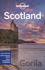
Lonely Planet's Scotland is your passport to the most relevant, up-to-date advice on what to see and skip, and what hidden discoveries await you... Zobraziť viac

🍌 Dodanie môže trvať viac ako 30 dní
19,95€
16,96€

Europa physisch 1:3 500 000

, freytag&berndt (2015)
Automapa

Road numbering, Car ferries, Index Zobraziť viac

🍌 Odosielame o 9 dní.
12,90€
10,97€

Unforgettable Journeys Europe

Unforgettable Journeys Europe

, Dorling Kindersley (2023)
Discover the Joys of Slow Travel

Inspirational travel book covering 150 of Europe's most incredible journeys, including routes on foot and by bike, road, rail and water... Zobraziť viac

🍌 Dodanie môže trvať viac ako 30 dní
32,95€
24,70€