
Kraj okolo Levíc, ktorý leží na sever od Dunaja, bol vďaka svojej úrodnej pôde a teplej klíme osídlený už od najstarších čias. Popri riekach Hron a Ipeľ prichádzali nové a nové kultúry, neskôr aj národy známe pod meno ako Kelti,... Zobraziť viac

Najväčšia kniha o Slovensku... Zobraziť viac

Nástenná mapa sveta s mierkou 1:35 000 000... Zobraziť viac

Veľká nástenná politická mapa v mierke 1:30 mil. Mapa je veľmi podrobná, obojstranne laminovaná. Na spodnej časti sú uvedené vlajky všetkých štátov sveta. Mapu dodávame v pevnom tubuse... Zobraziť viac
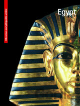
Egypt SLOVART - Česky, anlgicky, maďarsky, polsky - Edice: Obrazová encyklopedie umění - SLOVART - Jazyk: CZ - Vazba: Pevná s př Zobraziť viac

Farebná obrazová publikácia venovaná mestu Prešov a jeho okoliu s dôrazom na sakrálne pamiatky. Sprievodný text v slovečine, angličtine, nemčine, poľštine, ruštine a francúzštine. Zobraziť viac

Whether you want to tread the footsteps of kings and queens in Buckingham Palace, take in the bloody history of the Tower of London, or explore one of the city's numerous parks, your DK Eyewitness travel guide makes sure you experience all that London... Zobraziť viac
Neben der übersichtlichen Gestaltung bietet das Autokarten Set "Estland 1:150.000" zahlreiche Zusatzinformationen wie z.B. Straßenbeschaffenheit, Sehenswürdigkeiten, Campingplätze und diverse Innenstadtpläne. Mit dem umfangreichen Ortsregister gelingt... Zobraziť viac
Michelin Spain & Portugal 2016 Michelin tourist and motoring Atlas is the perfect companion for a safe and enjoyable journey in Spain and Portugal. Convenient and easy to use thanks to its spiral bound cover, this atlas will provide you with precise and.. Zobraziť viac

Set dvou oboustranných map 1:150 000 (jih a sever země) a drobného průvodce. V silničních mapách vyznačeny názvy sjezdů a nájezdů dálnic, cyklotras a 15 TOP turistických míst (popsaných v přiložené brožurce... Zobraziť viac

Přehledný autoatlas Islandu v měřítku 1:150 000 z edice map Freytag & Berndt, který lze využít nejen k plánování, ale osvědčí se i jako nepostradatelný průvodce během cesty. Aby se islandští návštěvníci zorientovali na ostrově... Zobraziť viac
Wanderatlanten sind dank der detaillierten digitalen Kartographie und der genauen Maßstäbe ideale Begleiter beim Wandern, Bergsteigen und auf Skitouren. Sie werden regelmäßig überarbeitet und enthalten aktualisierte Informationen... Zobraziť viac

Der neue kompakte Wanderatlas Wienerwald bietet einen umfassenden Kartenteil über die gesamte Wienerwald Region sowie einen Teil der Gutensteiner Alpen im Maßstab 1:40 000. Ein eigener Abschnitt gibt einen Überblick über die Region, sowie... Zobraziť viac

Stírací mapa světa XXL ve zlatém provedení a v krásném coffee designu... Zobraziť viac

Stírací mapa světa ve stříbrném provedení a v anglickém jazyce... Zobraziť viac

Autokarten sind für viele Länder und Regionen weltweit erhältlich. Neben der übersichtlichen Gestaltung verfügen die Straßenkarten über zahlreiche Zusatzinformationen wie z.B. Straßenbeschaffenheit, Sehenswürdigkeiten, Campingplätze und diverse... Zobraziť viac

Neben der übersichtlichen Gestaltung bietet das Straßenkarten-Set Sardinien 1:150.000 zahlreiche Zusatzinformationen wie z.B. Straßenbeschaffenheit, Sehenswürdigkeiten, Campingplätze und diverse Innenstadtpläne... Zobraziť viac

DK Eyewitness Travel Guide: Egypt is your in-depth guide to the very best of the oldest tourist destination on Earth... Zobraziť viac

The world of contemporary mapmaking is brought up-to-date in this revised and expanded edition of a best-selling book. For centuries we have used the tools of cartography to represent both our immediate surroundings and the world at large... Zobraziť viac


