Cykloturistické mapy v měřítku 1 : 125 000 obsahují cyklistické trasy v dané oblasti s uvedením výškových profilů, důležité adresy a kontakty, zajímavé tipy – v německém a anglickém jazyce a barevné fotografie... Zobraziť viac
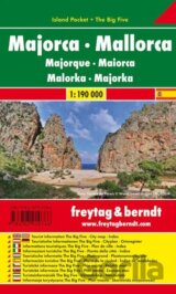
Explore Mallorca with this Freytag&Berndt small and laminated map. The best way to plan your trip to this part of the Balearic Islands and to travel independently. This pocket map contains touristic information on 5 themes: shopping... Zobraziť viac

Explore Madeira with this Freytag&Berndt small and laminated map. The best way to plan your trip on this island in the Atlantic Ocean and to travel independently... Zobraziť viac

Autoatlas vychází v edici „Cestujeme bez brýlí“ a je určen všem uživatelům, kteří mají problém se čtením drobných textů a informací v atlasech a mapách. Tento atlas jistě ocení nejen senioři... Zobraziť viac

Automapa kempů v měřítku 1:500 000. Přehledná automapa která přináší Informace o certifikovaných kempech po celé ČR. Obsahuje podrobné informace o jednotlivých kempech... Zobraziť viac

The Croatia Road and Leisure Map Pack contains 2 folded maps of Croatia and a leisure guide with top destinations, cycling routes, city maps, and a comprehensive index... Zobraziť viac

Elektronický slovník obsahuje niekoľko tisíc hesiel. Zobraziť viac

Diese politische Europakarte im Maßstab 1:6.000.000 besticht durch Ihre besonders intensive Farbgestaltung. Beschriftung in englischer Sprache. freytag & berndt Poster sind gerollt in einer stabilen Kunststoff-Rolle verpackt... Zobraziť viac

Neben der übersichtlichen Gestaltung bietet das Autokarten Set "Estland 1:150.000" zahlreiche Zusatzinformationen wie z.B. Straßenbeschaffenheit, Sehenswürdigkeiten, Campingplätze und diverse Innenstadtpläne. Mit dem umfangreichen Ortsregister gelingt... Zobraziť viac

Der City Pocket Stadtplan "Belgrad 1:10.000" bietet zahlreiche Zusatzinformationen wie öffentliche Verkehrsmittel und Sehenswürdigkeiten. Im umfangreichen Index finden Sie außerdem jede Adresse... Zobraziť viac

Autokarten sind für viele Länder und Regionen weltweit erhältlich. Neben der übersichtlichen Gestaltung verfügt die Straßenkarte Korfu über zahlreiche Zusatzinformationen wie z.B. Straßenbeschaffenheit, Sehenswürdigkeiten und Campingplätze... Zobraziť viac

Autokarten sind für viele Länder und Regionen weltweit erhältlich. Neben der übersichtlichen Gestaltung verfügen die Straßenkarten über zahlreiche Zusatzinformationen wie z.B. Straßenbeschaffenheit, Sehenswürdigkeiten, Campingplätze und diverse... Zobraziť viac


Cyklistická a rekreační mapa v Korutanské jezerní oblasti. Nejlepší způsob, jak si naplánovat výlet na kole v této části Rakouska. Tato mapa obsahuje turistické informace v němčině a angličtině... Zobraziť viac

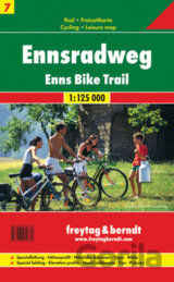
Cykloturistická mapa Murské cyklostezky (Mur-Radweg) v měřítku 1:125 000. Obsahuje též: - praktické informace - popis zajímavostí na trase - cyklostezky značené s kilometráží a výškovým profilem Provedení: skládaná, měkká obálka,... Zobraziť viac
Interaktives Kurs- und Arbeitsbuch mit Spielen: alle Kursbuch-Spiele sind interaktiv umgesetzt, zahlreiche zusätzliche interaktive Spiele lockern den Unterricht auf; viele interaktive Übungen aus Kurs- und Arbeitsbuch; ... Zobraziť viac

Explore Salzburg Land with this Freytag&Berndt road map. The best way to plan your trip, prepare your itinerary, and to travel independently in this part of central Austria. Top10 Tips: This map includes a Top10 of most interesting sights... Zobraziť viac

Der City Pocket Stadtplan Tallinn 1:10.000 bietet zahlreiche Zusatzinformationen und Sehenswürdigkeiten. Im umfangreichen Index finden Sie außerdem alle Adressen. Alle Inhalte werden natürlich regelmäßig aktualisiert... Zobraziť viac

