Cykloturistické mapy v měřítku 1 : 125 000 obsahují cyklistické trasy v dané oblasti s uvedením výškových profilů, důležité adresy a kontakty, zajímavé tipy – v německém a anglickém jazyce a barevné fotografie... Zobraziť viac
Podrobná mapa v měřítku 1 : 50 000 (1 cm = 500 metrů) zobrazuje vedle základního obsahu (všechna sídla a jejich části, železnice, silnice, hlavní cesty, vrstevnice, výškové kóty atd.) také kompletní síť turistických značených cest... Zobraziť viac
Explore Mallorca with this Freytag&Berndt small and laminated map. The best way to plan your trip to this part of the Balearic Islands and to travel independently. This pocket map contains touristic information on 5 themes: shopping... Zobraziť viac

Abenteuer, Kulinarik, Kultur, Natur, Sehenswürdigkeiten, Symbole in Karte Piktogramme, 10 Sprachen... Zobraziť viac
Explore Madeira with this Freytag&Berndt small and laminated map. The best way to plan your trip on this island in the Atlantic Ocean and to travel independently... Zobraziť viac
Autoatlas vychází v edici „Cestujeme bez brýlí“ a je určen všem uživatelům, kteří mají problém se čtením drobných textů a informací v atlasech a mapách. Tento atlas jistě ocení nejen senioři... Zobraziť viac
Kromě jasného designu nabízí mapa ulice „Chorvatsko 1: 500 000“ řadu dalších informací, jako jsou památky, kempy a plány ve městě. S rozsáhlým místním registrem je rychlá orientace úspěšná. Mapa ulice Chorvatsko 1: 500 000... Zobraziť viac
Najobľúbenejšie a popredné turistické mapy z dielne tradičného slovenského vydavateľa VKÚ Harmanec. Mapa prešla kompletnou podrobnou aktualizáciou každej lokality miestnym šetrením osobne... Zobraziť viac

Podrobná mapa v měřítku 1 : 50 000 (1 cm = 500 metrů) zobrazuje vedle základního obsahu (všechna sídla a jejich části, železnice, silnice, hlavní cesty, vrstevnice, výškové kóty atd.) také kompletní síť turistických značených cest... Zobraziť viac
Automapa kempů v měřítku 1:500 000. Přehledná automapa která přináší Informace o certifikovaných kempech po celé ČR. Obsahuje podrobné informace o jednotlivých kempech... Zobraziť viac
Rozkládací přehledná mapa. Tabulka vzdáleností, rejstřík obcí. 3 plány měst... Zobraziť viac
The Croatia Road and Leisure Map Pack contains 2 folded maps of Croatia and a leisure guide with top destinations, cycling routes, city maps, and a comprehensive index... Zobraziť viac
Podrobná mapa v měřítku 1 : 50 000 (1 cm = 500 metrů) zobrazuje vedle základního obsahu (všechna sídla a jejich části, železnice, silnice, hlavní cesty, vrstevnice, výškové kóty atd.) také kompletní síť turistických značených... Zobraziť viac
Elektronický slovník obsahuje niekoľko tisíc hesiel. Zobraziť viac
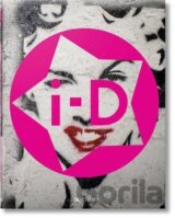
In celebration of 30 years at the forefront of international fashion and lifestyle publishing, this book, edited by Creative Director and i-D founder Terry Jones, features all of the iconic covers to date as well as the best stories behind the... Zobraziť viac
Der City Pocket Stadtplan "Belgrad 1:10.000" bietet zahlreiche Zusatzinformationen wie öffentliche Verkehrsmittel und Sehenswürdigkeiten. Im umfangreichen Index finden Sie außerdem jede Adresse... Zobraziť viac
Autokarten sind für viele Länder und Regionen weltweit erhältlich. Neben der übersichtlichen Gestaltung verfügt die Straßenkarte Korfu über zahlreiche Zusatzinformationen wie z.B. Straßenbeschaffenheit, Sehenswürdigkeiten und Campingplätze... Zobraziť viac
Neben der übersichtlichen Gestaltung bietet das Autokarten Set "Estland 1:150.000" zahlreiche Zusatzinformationen wie z.B. Straßenbeschaffenheit, Sehenswürdigkeiten, Campingplätze und diverse Innenstadtpläne. Mit dem umfangreichen Ortsregister gelingt... Zobraziť viac
Diese politische Europakarte im Maßstab 1:6.000.000 besticht durch Ihre besonders intensive Farbgestaltung. Beschriftung in englischer Sprache. freytag & berndt Poster sind gerollt in einer stabilen Kunststoff-Rolle verpackt... Zobraziť viac